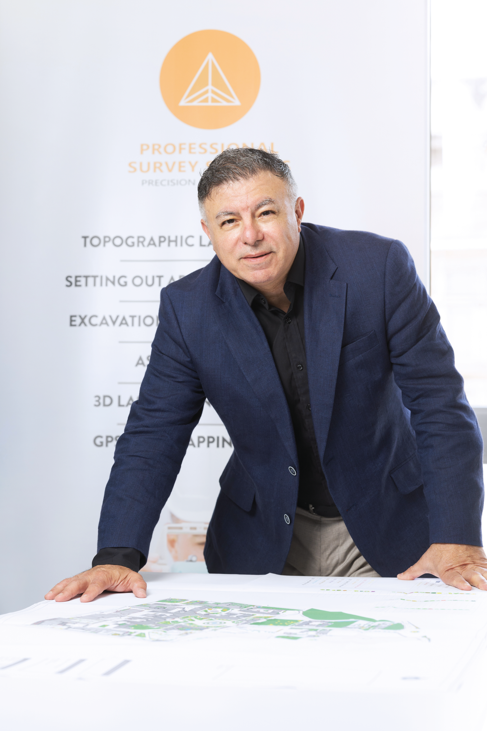
Interview with Christopher Cassar; Proprietor, Professional Survey Services
Land surveying is one of those trades that tends to work in the background. Yet its role is fundamental. Without it, a project cannot begin, a plan cannot be drawn, and a structure cannot be guaranteed to stand where and how it should.
Professional Survey Services, or PSS, is one of the few Malta-based outfits that has scaled its operations to meet the full breadth of modern surveying demands — from ground-based measurements and volumetric studies to 3D laser scanning and remote drone surveys.
The company was formally established in 2020, but its leadership and staff bring experience that extends far beyond the past few years. The company’s founder, Christopher Cassar, began his career in engineering and vehicle design, with active involvement in international consultancy and manufacturing work in Asia and the Middle East.
The move into surveying was not an abrupt shift, but a response to an observed lack of consistent, high-quality survey services locally. “There were capable individuals on the island, but the sector was fragmented,” Cassar explains. “There was room for something more structured, more methodical — and better equipped.”
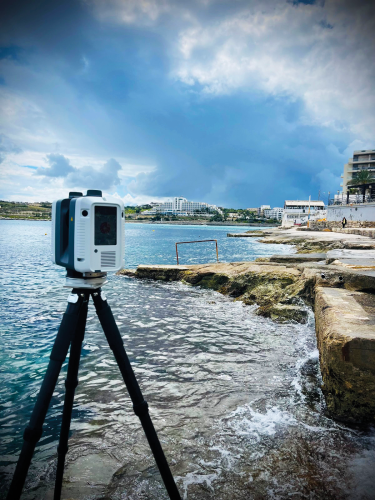
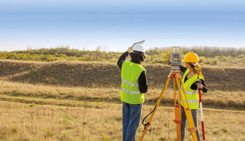
PSS offers a comprehensive suite of surveying services. These include 2D and 3D land surveys, drone-enabled RTK mapping, laser scanning, setting out, as-built surveys, ground-penetrating radar (GPR), and volumetric measurements. Each method is selected and applied depending on the type, scale, and sensitivity of the project in question. One of the company’s differentiating factors is its wide and technically advanced equipment base. The team makes use of Leica RTC360 laser scanners, RTK GPS systems, and drones capable of producing centimetre-level terrain models. “We choose our equipment with interoperability and speed in mind,” Cassar says. “We don’t buy gear for show. We use what allows us to work efficiently across various environments – from excavation sites to heritage zones.”
Their ground-penetrating radar, for instance, has been used to detect buried voids, shelters, and wells before excavation begins. In some cases, this has prevented costly delays or structural damage. “We’ve also used it in cases where a developer is working near a protected structure,” Cassar notes. “In these situations, being able to identify what lies beneath is absolutely necessary.
“Their ground-penetrating radar …has been used to detect buried voids, shelters, and wells before excavation begins”
Laser scanning also plays a central role. The ability to create precise point clouds for digital modelling is especially valued by architects and engineers. Using software like Revit, these models can then be translated into actionable data for structural design or alteration. “It reduces rework. It speeds up project planning. And it provides a clear, verifiable record of a space,” Cassar explains.
“Discrepancies are common,” Cassar says. “Rather than delay compliance or handover, the architect can use our data to apply for minor amendments with the Planning Authority, supported by accurate records.” Even core drilling, typically the domain of specialist contractors, sometimes involves PSS when accuracy is critical. In one case, a client required horizontal drilling to intersect a pre-existing drainage channel behind a solid wall. “They couldn’t afford a mistake,” Cassar recalls. “We mapped it out so that they didn’t need to tear up a road or guess where to start.”
Capacity and Contingency
PSS currently employs 15 qualified surveyors, supported by administrative staff. According to Cassar, the company can handle up to 15 projects simultaneously, depending on their complexity. Importantly, each team is capable of independently resolving unforeseen job situations without the need of the intervention of the back-office. Furthermore, equipment is calibrated regularly, and spare systems are kept on standby in case of damage or malfunction. “We run multiple Leica scanners and RTK kits,” he explains. “If something breaks or has to go for recalibration, we don’t stop work. That’s not something we can afford to do — nor can our clients.”
The firm also offers retainer agreements, which are particularly useful for developers managing multi-phase or long-term projects. These agreements allow for continuous support without the need to renegotiate service terms for each new stage of work.
This model has allowed PSS to operate with agility. From short-notice site surveys to long-term volumetric monitoring, the team is structured to respond quickly and with constant precision.
“From short-notice site surveys to long-term volumetric monitoring, the team is structured to respond quickly and with constant precision”
Building Competence Beyond the Company
PSS’s growth has brought with it an awareness of structural gaps in Malta’s surveying ecosystem. Chief among these is the lack of advanced training opportunities for aspiring surveyors. While MQF Level 4 courses exist, there are few pathways for further formal development. In response, Cassar is working to establish a dedicated surveying school, both to improve local standards and to secure a pipeline of new talent. “We’ve always trained internally,” he says. “But there’s scope to do more. Malta needs more surveyors – and those surveyors need a path to accreditation.”

The proposed school would deliver structured training aligned with European frameworks and focused on practical competence. It also supports the company’s longer-term strategy. PSS is expanding into neighbouring regions, including Libya, where its team is already providing technical support in coordination with architectural firms.
An organisation with clear purposes
What clients value in PSS is not only precision, but structure. Large developments need reliable measurements, yes – but they also need reports delivered on time, files presented in the right format, and “work done right the first time around”. PSS has built its reputation on being able to provide these things consistently. They are now commonly engaged for volumetric surveys, especially in excavation and quarry work, where material removed must be measured precisely.

“Malta needs more surveyors – and those surveyors need a path to accreditation”
As infrastructure projects grow in scale and complexity, the surveying inputs required to support them must keep pace. PSS has positioned itself to meet that demand by maintaining operational depth, technical relevance, and a clear understanding of client expectations.
“(PSS) has gained the confidence of some of Malta’s largest developers and construction contractors”
Professional Survey Services is not positioned as a disruptor or innovator in the loose sense. It is, instead, a company that has focused on delivering a core technical service with consistency, accuracy, and attention to operational process. In doing so, it has gained the confidence of some of Malta’s largest developers and construction contractors.

By investing in technology, maintaining a qualified team, and addressing gaps in local education, PSS is not simply responding to demand, but helping to shape how that demand is met. As Malta’s building landscape continues to evolve, PSS appears committed to staying close to the ground – both literally and strategically.
Comment